Save
Saved
Share
Photos
About
Details
Open Houses
Listed by
Buyer agent
Payment calculator
Lot details
Neighborhood
Utilities
Location Details, Documents & Disclosures
Price history
Taxes
Agent viewpoints
Similar land for sale
Recently sold land
Recently sold homes
Similar homes for sale
Request more info
FAQ
Contact agent
Save
Saved
Map View
Land sold for $878,000 in 72 days

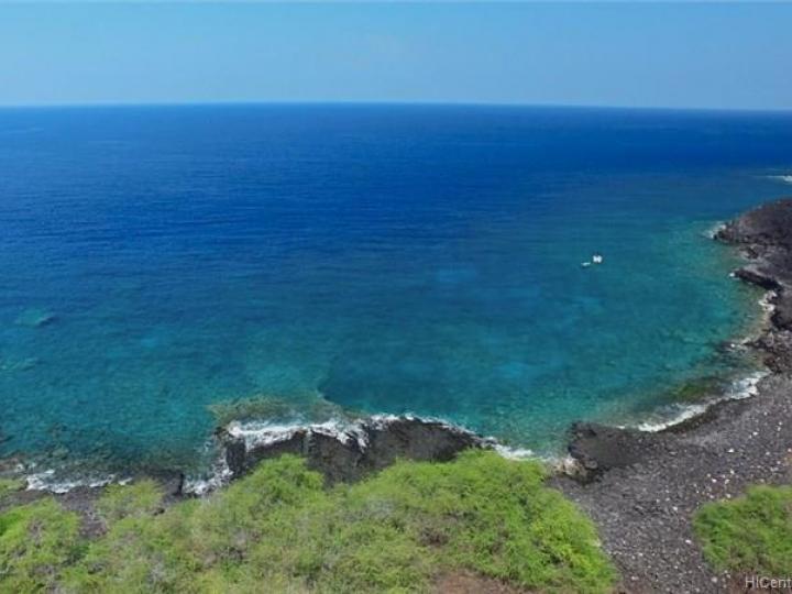
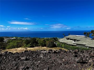
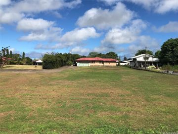
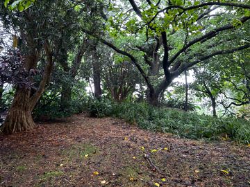
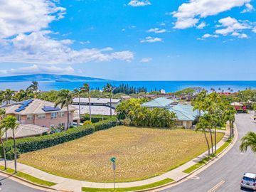
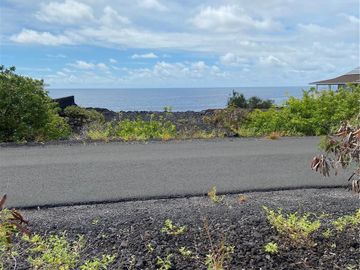
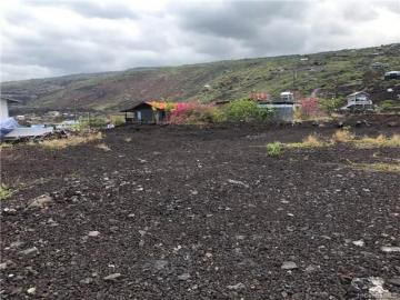
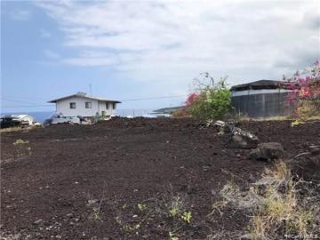
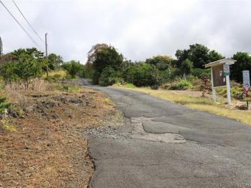
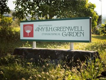
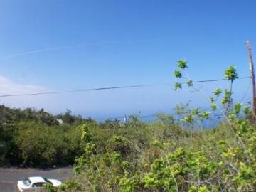
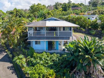
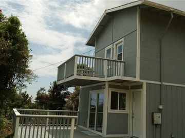
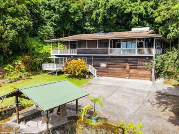
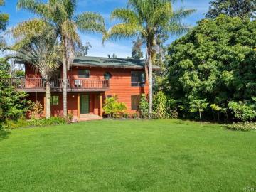
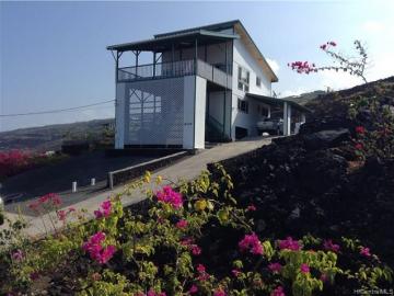
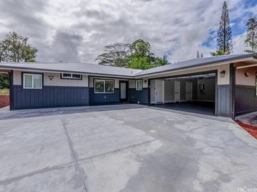
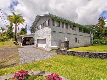
88-1575 Hawaii Belt Rd Captain Cook, HI, 96704

Neighborhood: Papa Hmstd

Off the market 222.72 acres

Do you own this home?

Access your homeowner dashboard

Undeveloped 222 acres directly between Papa Bay and Milolii which runs from the Hawaii Belt Rd to the ocean. Property has multiple uses with Agricultural and Conservation zoning. The approximately 400’ ocean frontage is easily accessed via a chained-off public walking path on 5 acres owned by the Milolii Beach Club Association. An ancient rock wall runs the length of much of the property. Highway frontage begins near to the south side of Papa Bay Rd and the north side of Milolii Rd and is a thick entanglement of trees which include Christmas Berry, but once inside, there are Macadamia Nut, Avocado, Jaboticaba and Ti to name a few.
Read more

Property details

Big Island county
View
Coastline, Ocean, Sunset
Land area
9,701,683 sqft (222.72 acres)
Price per sqft
$0/sqft
Address
88-1575 Hawaii Belt Rd, Captain Cook, HI, 96704
City of Hawaii
Captain Cook
Island
Big Island
Frontage
Conservation, Ocean
Land tenure
FS - Fee Simple
Neighborhood
Papa Hmstd
District
S. Kona
Zoning
50 - Agricultural

Open Houses

No upcoming open houses

Listed by

Beth Robinson, Hawaii Life Real Est. Brokers
Name
Beth Robinson
Brokerage company
Hawaii Life Real Est. Brokers
MLS #
201801304

Buyer agent

Name
NON MLS
Brokerage company
Non-MLS

Payment calculator

Calculate your monthly payments
Mortgage
$2,696
Taxes
$713
HOA dues
$0
$3,409 per month
Mortgage
$175,600 / 20%
2.28%
30 years
Your amount $2,696 / month

Lot details

TMK #3880030010000
Parcel #
3880030010000

Papa Hmstd neighborhood info

Essentials nearby
Neighborhood stats
Walkability
Coffee shops
—
no data
Bus stop
—
no data
Supermarket
—
no data
Costco
—
no data
Hospital
—
no data
Park
—
no data
Beach
—
no data
Elementary school
—
no data
Middle school
—
no data
High school
—
no data
Local airport
—
no data

People living in Papa Hmstd

25%
Families with children
National average: 39%
21%
Non family households
49,461
Population
$-333,249,529
Average Income

Age & gender

Median age 44 years
More info

Commute types

-66006535% commute by car
More info

Education level

26% have high school education
More info

Number of employees

4% work in entertainment services
More info

Vehicles available

39% have 2 vehicle
More info

Vehicles by gender

39% have 2 vehicle
More info

Housing market insights for

Housing type

75% are single detacheds
More info

Rooms

46% of the houses have 4 or 5 rooms
More info

Bedrooms

65% have 2 or 3 bedrooms
More info

Owners vs Renters

70% are owners
More info
5 / 20
Least Walkable
15-20
10-15
5-10
1-5
Walkability according to the National Walkability Index

Utilities

None
Utilities
None

Location Details, Documents & Disclosures

Documents & disclosure
Property Disclosure Stmt

Price history

Sold Aug 6, 2018

Papa Hmstd Median sales price 2018

Bedrooms Med. price % of listings
No data for selected period
Date Event Price $/sqft Source
Aug 6, 2018 Sold $878,000 0.09 Public Record
Aug 6, 2018 Price Decrease $878,000 -11.21% 0.09 MLS #201801304
Apr 4, 2018 Under contract $988,888 0.1 MLS #201801304
Jan 19, 2018 New Listing $988,888 0.1 MLS #201801304

Taxes of 88-1575 Hawaii Belt Rd, Captain Cook, HI, 96704

50 - Agricultural zoning / MLS #201801304
Current Property Taxes p/month
$712
Assessed Improvement value
$0
Assessed Land value
$912,800
Land Recorded
Regular System
Flood Zone
Zone X
Topography
Gentle Slope
Location
Other
Total Assessed value
$912,800

Tax History

Year Taxes Source
2017 $8,554 MLS #201801304
Show more Show less
About Tax & History Data: We obtain the price and history data from public records and / or from local MLS feeds. Please use the contact form on this page if you would like the most up-to-date information.

Agent viewpoints of 88-1575 Hawaii Belt Rd, Captain Cook, HI, 96704

No reviews yet
Stunning views
Open floorplan
Needs Work
Street noise
Show more Show less
We do not have an Agent Viewpoint for this listing yet.
As soon as we do, we post it here.

Request more info

Frequently Asked Questions about 88-1575 Hawaii Belt Rd

What is 88-1575 Hawaii Belt Rd?

88-1575 Hawaii Belt Rd is a lot of 222.72 acres (about is 9,701,683 sqft).

What is the full address of this Land?

88-1575 Hawaii Belt Rd, Captain Cook, HI, 96704.

Based on information from the Multiple Listing Service of HiCentral MLS, Ltd. Copyright 2024 by HiCentral Mls, Ltd. Listing courtesy of Hawaii Life Real Est. Brokers.
Our company may forward your question(s), email address, phone number, name, and any other information you may provide to a licensed real estate agent in the state where the property you are inquiring about is located. We forward your information to assist you in getting you the answers you are requesting. However, you are not obligated to work with this agent. The agent we forward your information to may or may not be the listing agent for the property. Please discuss with the agent regarding your options for representation. Information deemed reliable but not guaranteed.

Listing last updated: Aug 10, 2018
Verhouse Last checked 5 minutes ago


The Papa Hmstd neighborhood has a population of 49,461, and 25% of the families have children. The median age is 44.24 years and -66006535% commute by car. The most popular housing type is "single detached" and 70% is owner.
Land Sold $878k 88-1575 Hawaii Belt Rd, Captain Cook, HI, 96704 222.72 acres Save House Remove from Saved